Data & Insight Showcase - Spatial Data Science
geospatial
map
data science
When data science meet geographical information data
Introduction
What is spatial data science?
spatial data science is a process to solving problems what relate to spatial algorithms and geographical data (location, address, longlat, etc).
Why we need to implement this?
Some business’s partners and users have specific ecosystems and have unique proportions. The influence of geographic data, such as location, can help us make better decisions, predictions, and conclusions. Moreover, location helps us understand the relationship between data and allows us to contextualize the data.
As argued by the geographer Waldo Tobler:
Everything is related to everything else, but near things are more related than distant things.
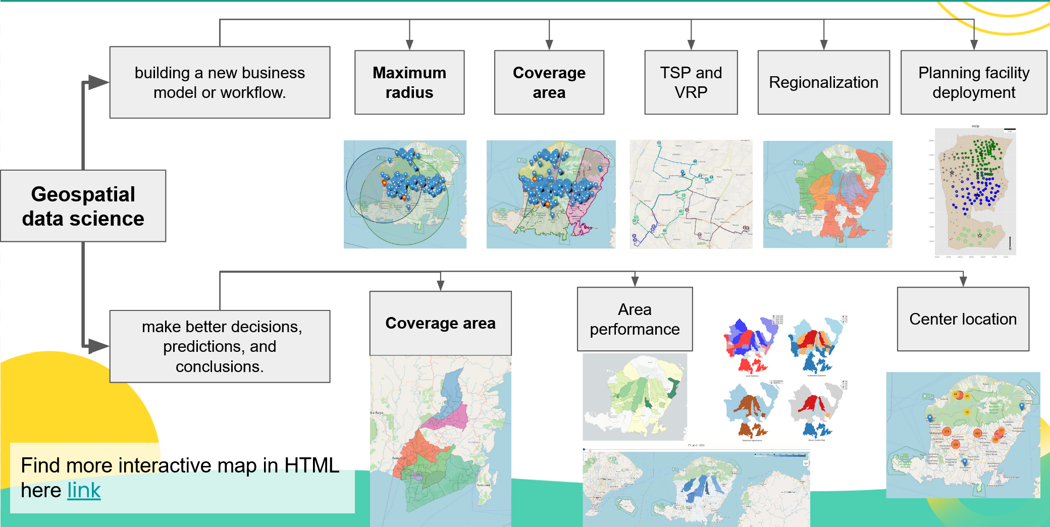
We categorize usecase of geospatial data science into two categories:
- The cases that need help building a new business model or workflow.
- The cases that need help to make better decisions, predictions, and conclusions.
Showcase